


LIBERTYVILLE 199 Voting District, Lake County, Illinois
About
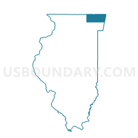
Outline

Summary
| Unique Area Identifier | 572071 |
| Name | LIBERTYVILLE 199 Voting District |
| County | Lake County |
| State | Illinois |
| Area (square miles) | 1.05 |
| Land Area (square miles) | 1.01 |
| Water Area (square miles) | 0.03 |
| % of Land Area | 96.82 |
| % of Water Area | 3.18 |
| Latitude of the Internal Point | 42.24644400 |
| Longtitude of the Internal Point | -87.89469710 |
Maps


Graphs
Select a template below for downloading or customizing gragh for LIBERTYVILLE 199 Voting District, Lake County, Illinois


Neighbors
Neighoring Voting District (by Name) Neighboring Voting District on the Map
- LIBERTYVILLE 178 Voting District, Lake County, IL
- LIBERTYVILLE 179 Voting District, Lake County, IL
- SHIELDS 248 Voting District, Lake County, IL
- VERNON 260 Voting District, Lake County, IL
- VERNON 261 Voting District, Lake County, IL
- WEST DEERFIELD 406 Voting District, Lake County, IL
Top 10 Neighboring County Subdivision (by Population) Neighboring County Subdivision on the Map
- Vernon township, Lake County, IL (67,095)
- Libertyville township, Lake County, IL (53,139)
- Shields township, Lake County, IL (39,062)
- West Deerfield township, Lake County, IL (31,077)
Top 10 Neighboring Place (by Population) Neighboring Place on the Map
Top 10 Neighboring Elementary School District (by Population) Neighboring Elementary School District on the Map
- Lake Forest School District 67, IL (19,064)
- Lincolnshire-Prairieview School District 103, IL (12,555)
- Rondout School District 72, IL (1,740)
Top 10 Neighboring Secondary School District (by Population) Neighboring Secondary School District on the Map
- Adlai E. Stevenson High School District 125, IL (61,187)
- Libertyville Community High School District 128, IL (49,926)
- Lake Forest Community High School District 115, IL (28,251)
Top 10 Neighboring State Legislative District Lower Chamber (by Population) Neighboring State Legislative District Lower Chamber on the Map
Top 10 Neighboring State Legislative District Upper Chamber (by Population) Neighboring State Legislative District Upper Chamber on the Map
Top 10 Neighboring 111th Congressional District (by Population) Neighboring 111th Congressional District on the Map
Top 10 Neighboring Census Tract (by Population) Neighboring Census Tract on the Map
- Census Tract 8662, Lake County, IL (5,871)
- Census Tract 8635, Lake County, IL (4,243)
- Census Tract 8646.01, Lake County, IL (3,733)